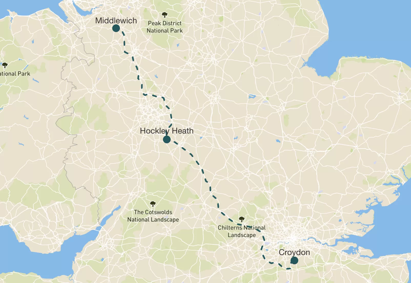
Today we had to give the boat back, which meant we had to pack everything up (mostly my Mum did that bit) and do a couple more locks on the way to the boatyard. It felt weird knowing it was our last morning on Rakiraki. I stood on the bow and waved at ducks. One of them ignored me.
After we said goodbye to the Burtons and the boat, we got in the car and started heading home. But first we went to see my Granny in Hockley Heath. We picked up some tasty treats from Wedges Bakery to have at her house for lunch.
Then we did the long drive back to Croydon, and we go home just before 6.30pm. I was a bit sad it was over, but also glad to be back in my own bed.
It was definitely a brilliant holiday. Boats, locks, tunnels, tractors, surprise ice creams, sneaky card games, swans on nests, and only a handful of minor disasters. I’d do it all again. Though maybe not the stuck in a lock bit.
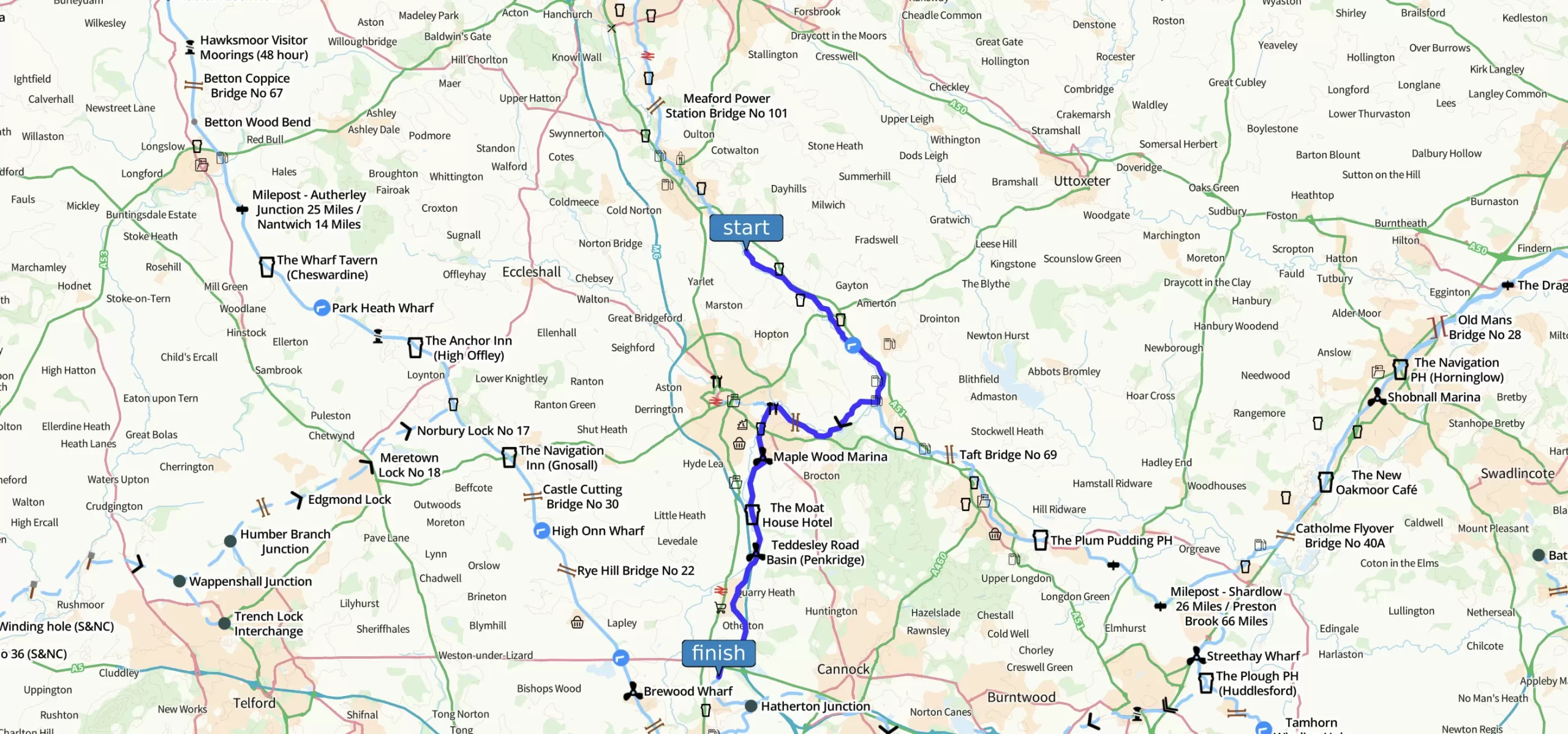
We were meant to have a nice slow day today with a canalside carvery (that’s a big roast dinner in a pub) but because of Treegate yesterday we had loads of catching up to do.
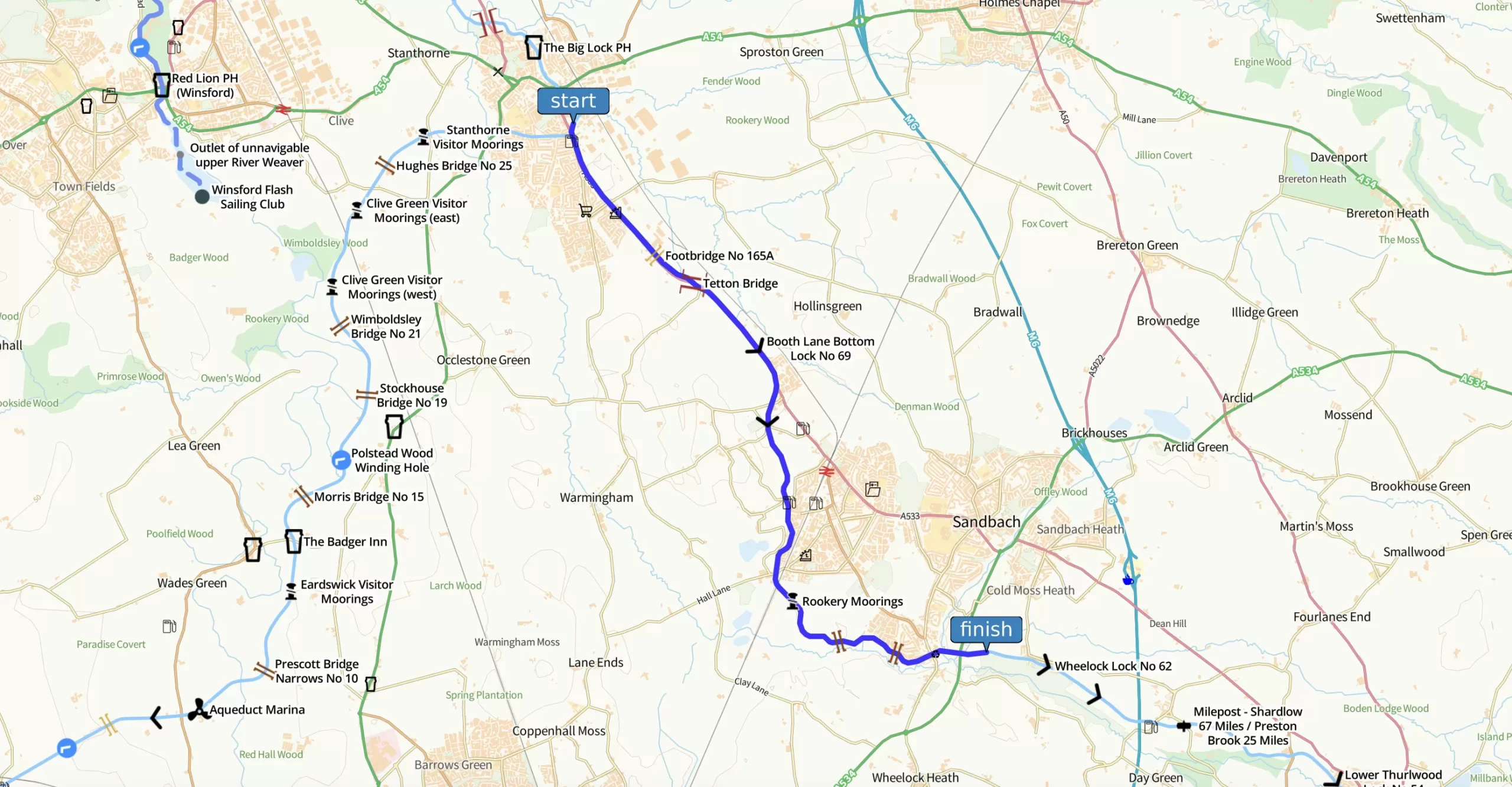
So we got up early again and started straight away with the Audlem local flight. For this hill into Nantwich, Thomas Telford had to build locks. Fifteen of them, but he built them in a pretty amazingly straight line. We got into a proper rhythm and zoomed through.
Then something brilliant happened. Our luck turned and we found ourselves sailing past Overwater Marina just as the cafe opened for breakfast. So, we stopped and swapped carvery plans for giant cooked breakfasts. We’d definitely earned it.
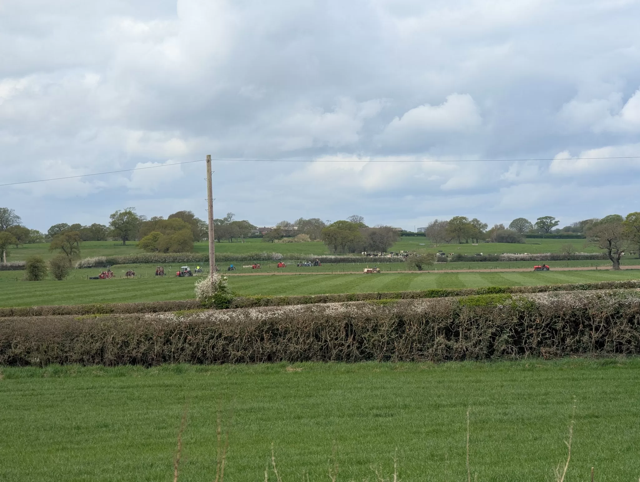
Later in the day we saw this procession of tractors of all shapes and sizes and makes and ages. We didn’t know what was going on but we think it was raising money for the British Heart Foundation in memory of a chap called Rob Vernon. Although it turns out there was another vintage tractor run happening nearby that same day to raise money for Eilidhs Trust and the Joshua Tree. I guess Cheshire loves tractors.
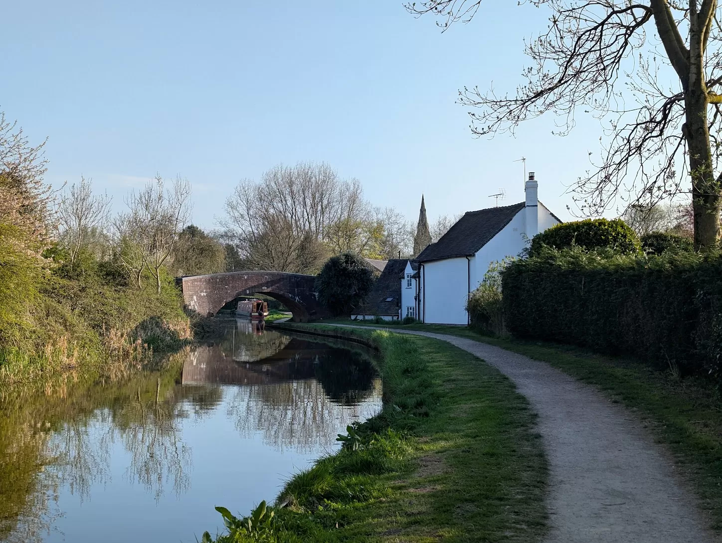
By the end of the day we moored up near a village called Church Minshull. We walked to the pub, The Badger Inn, for a drink as a group. It was a nice pub but the walk there really wasn’t great…there wasn’t a very good pavement and cars were going too fast. It was a bit scary really.
Still, it was great to be together on our last proper night. I didn’t want the trip to end.
We were meant to have a really long boating day today so we set off early. My Dad got up even earlier to fill up our water tank. It was surprising how long it was taking – we must have used a lot of water…
Then we found out one of our two toilet tanks was FULL. We figured out later on that the toilet flush was constantly running from the water tank into the sewage tank. So that’s why we needed more water and to get a pump out.
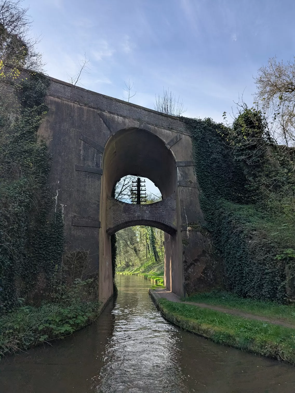
But once we got going we were back on more of the impressive embankments and dramatic cuttings of the Shroppie. There was also this funny “double” bridge which contains this old wooden pole that for something called ‘telegraphs’. That was how people sent messages more quickly than letters before telephones and text messages and emails and apps. People say a ghost lives here…but we didn’t see anything like that.
It was another glorious day on the canal. And even though we’d had an annoying start everything was going well.
Until it wasn’t.
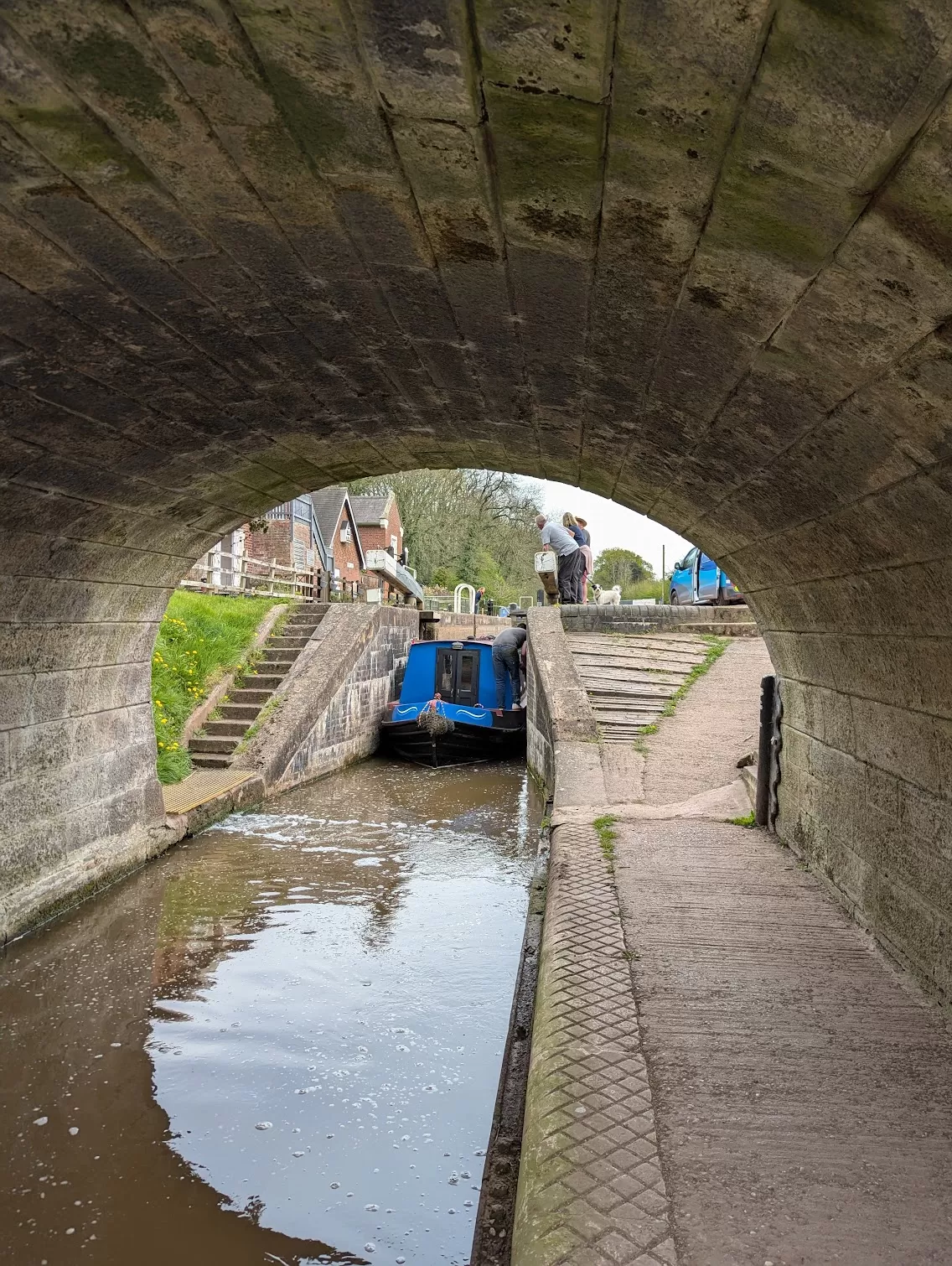
We started to go through the Tyrley Locks (you say it “Turley”). Dad and I went ahead to set the next lock. We opened our gate and looked behind expecting Rakiraki to sail towards us. We could see her bow but she wasn’t moving.
What had happened?
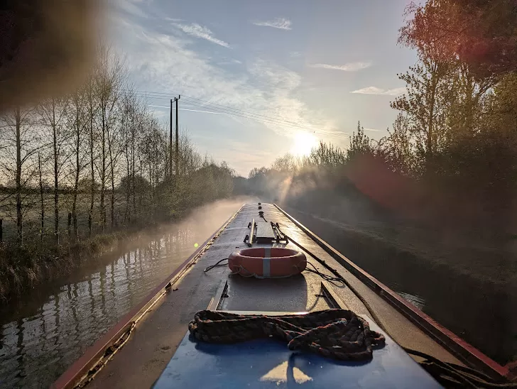
She was properly stuck. A really, really large tree log was in the water and it had got wedged between the wall of the lock and the hull of the boat. Rakiraki couldn’t move at all. Totally jammed. Other boat crews tried to help us but nothing worked. So we had to call on the Canal and River Trust.
They came with tools and even then it took them ages. They had to try and saw through the log until it gave and the boat dislodged. We were stuck for three whole hours! So grateful to the Canal and River Trust for getting us moving.
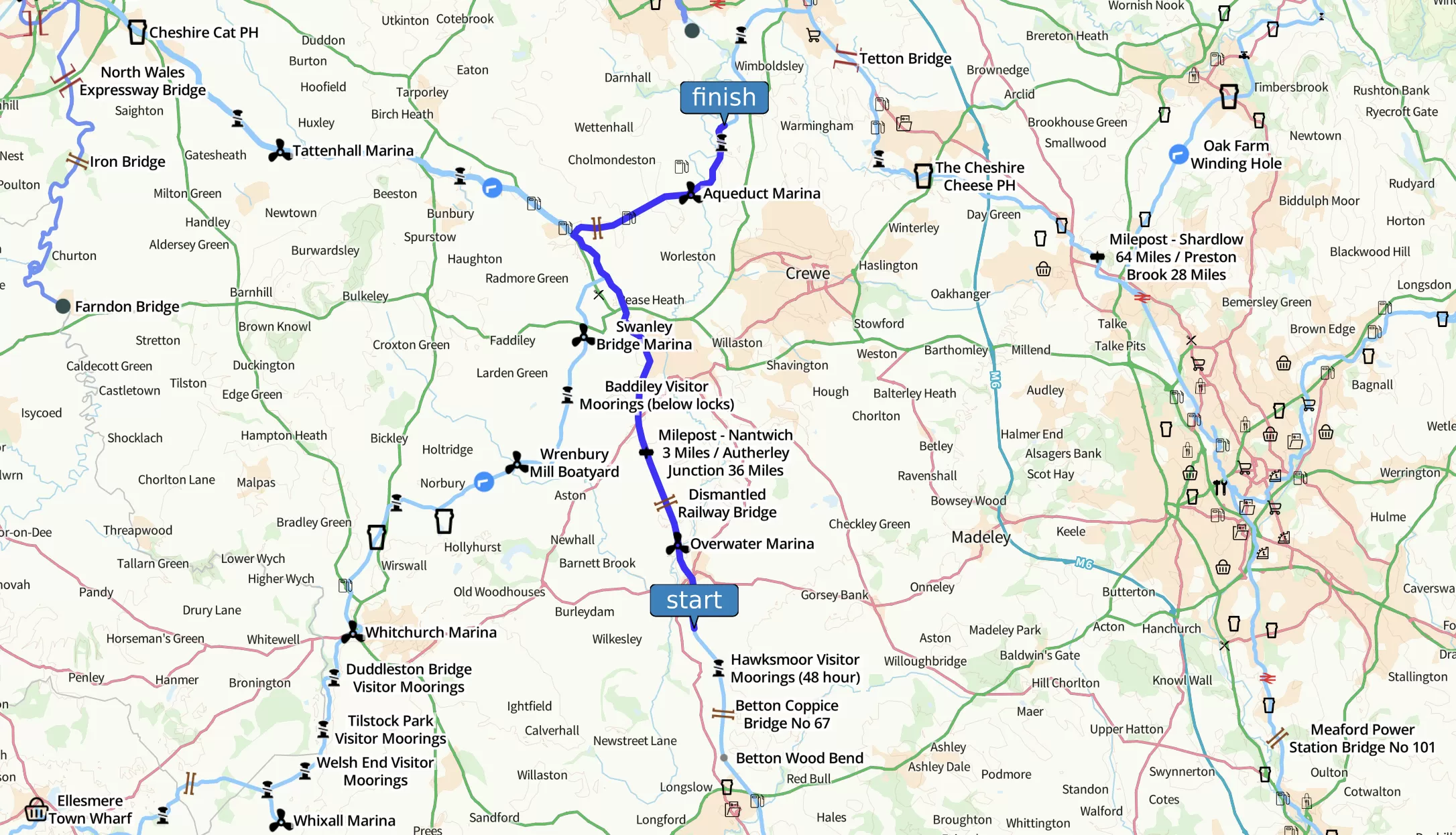
We were supposed to get to Audlem and do a load more locks but because of the toilet trouble and the tree trouble we only made it to the top of the flight. We now only had one day left before we had to give the boat back but we were still quite a long way away, tomorrow was going to be hard work.
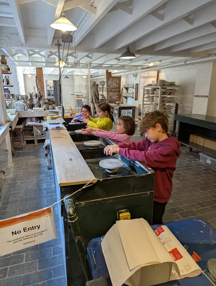
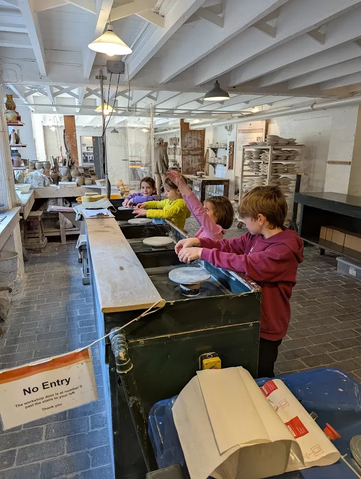
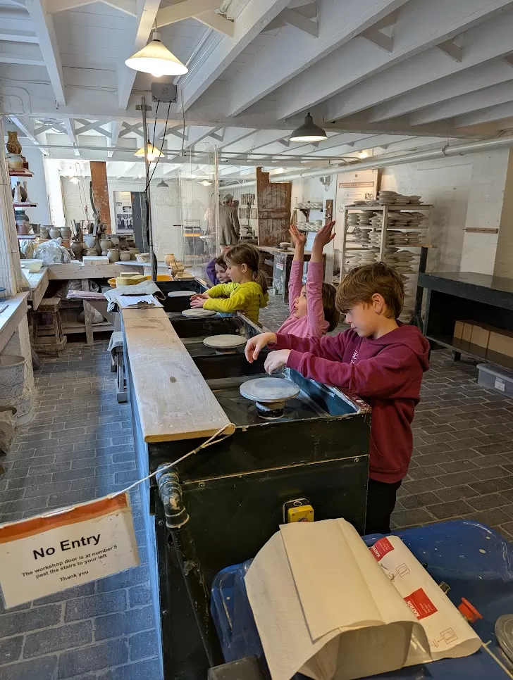
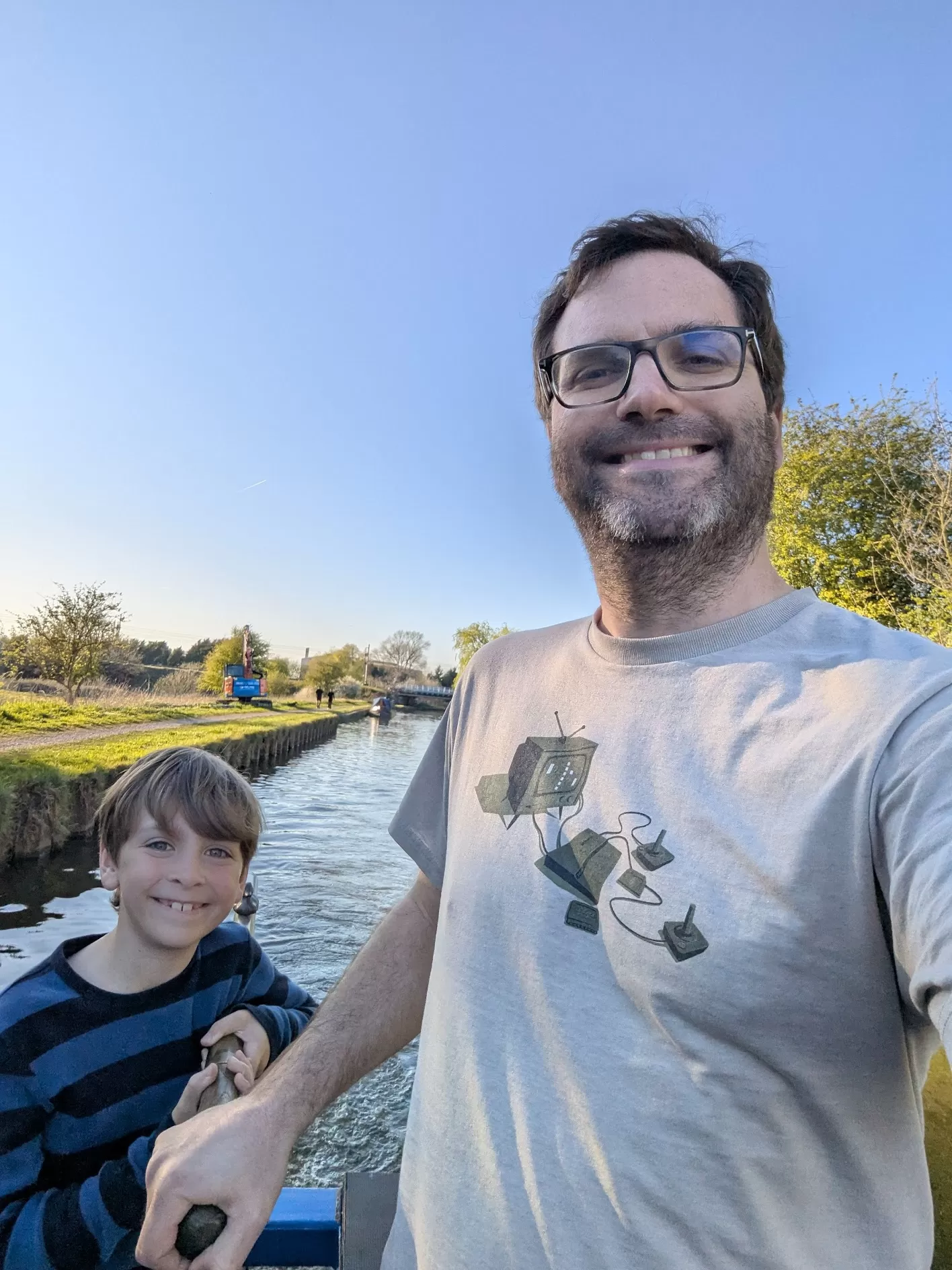
My Dad is annoyed that the stuck his finger over the lens in the left hand image, so he asked ChatGPT to fix it. It’s a good effort but it isn’t right is it.
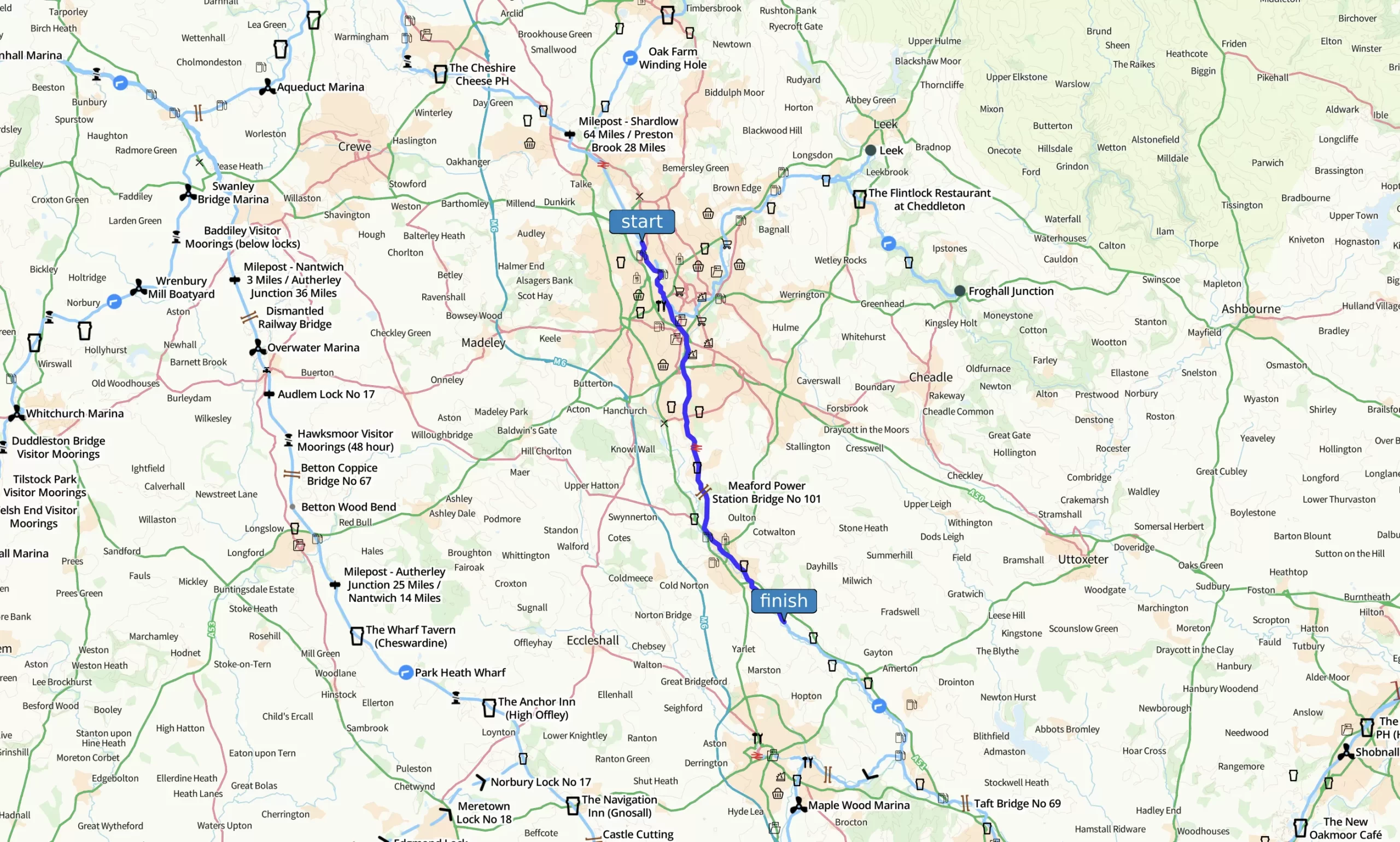
I used to think all canals were just bendy and slow with lots of locks. But today wasn’t like that at all.
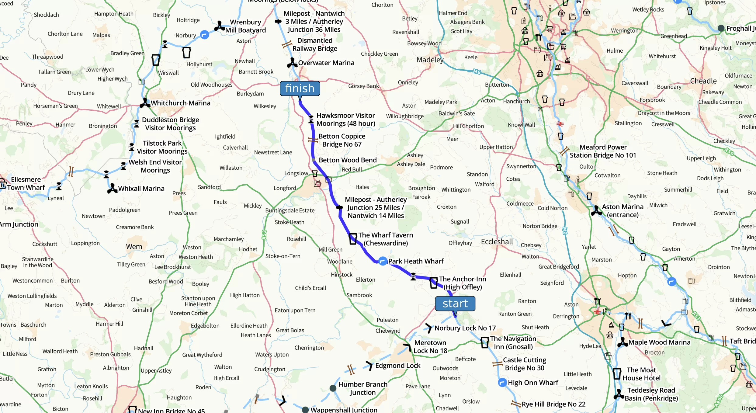
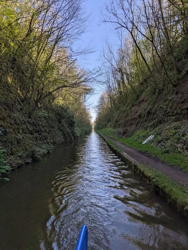
We joined a new canal called the Shropshire Union Canal, or the “Shroppie” which people call it for short. It felt totally different. We travelled 23 miles and only had to do TWO locks. One of them only changed the water level by 10 centimetres, which is basically nothing.
That’s all thanks to Thomas Telford—the same man who made Harecastle Tunnel from earlier in the week. He didn’t bother following the land, he went through it. He cut through hills, built embankments and bridges, and did everything he could to make the canal level and straight. The Shroppie was the last narrow canal built in England and opened in 1835. When it was new, people called it the “main line”. It was like a motorway for boats.
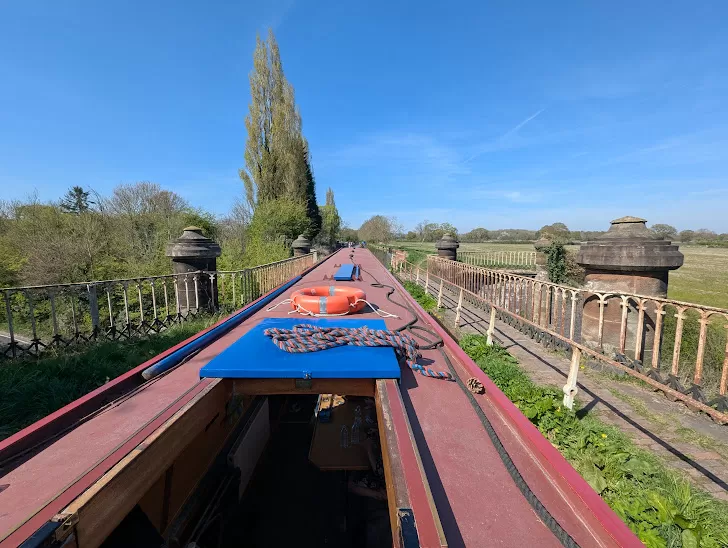
Going over Thomas Telford’s Stretton Aqueduct that crosses the A5 – which follows the route of an old Roman Road! This is an example of how Telford would ‘cut’ through the landscape to carve out the canal.
We stopped at a village called Brewood (which is actually pronounced “Brood”, weirdly). On the way to the playground we passed “Speedwell Castle”. Apparently someone built it in the 1700s after their horse won a race.
Even better than that fancy building was stopped at a bakery. And then stopping there again for cake on our way back to the boat. Yummy.
Back on the boat, I learned a game called Citadels with my godfather Dave. It’s a card game where you try to build a city and do sneaky things. I think I got the hang of it!
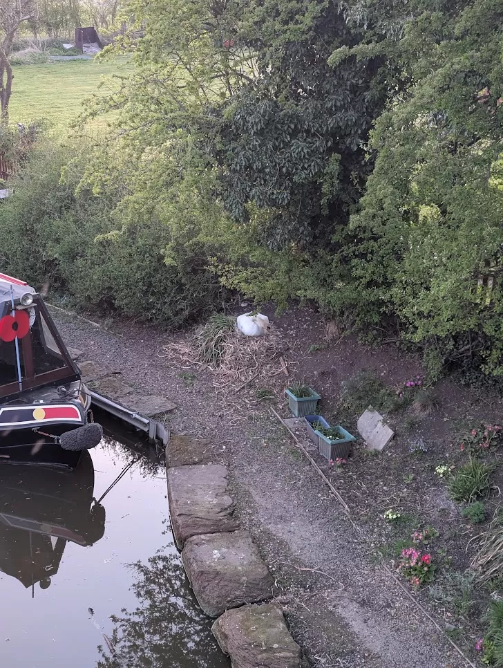
We finished the day at Norbury Junction. A long time ago, the Shrewsbury Canal joined here, and some people are trying to bring it back. Right now, the junction is home to lots of moored boats—and also to a pair of swans sitting on their nest. I didn’t get a photo, but I did catch a glimpse of the eggs when one of the swans shifted around. It felt like a secret moment.
We had dinner at the Junction Inn, sitting in the garden by the water as the sun set. The light made the whole canal glow golden. Today was a really good day.
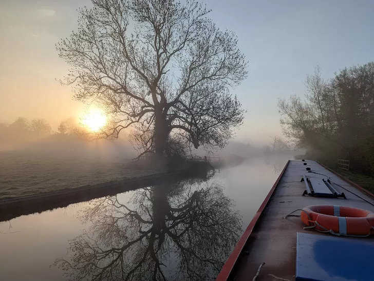
When I woke up and looked out the window, the roof of the boat was covered in ICE. In April! I touched it and it melted straight away but still. Ice. In the morning. On a boat!
But once the sun came out it got properly warm and the whole day turned out to be lovely.
Today we didn’t really have any big stops, just kept going along the canal. We changed canals again, this time we joined the Staffordshire and Worcestershire Canal – and that’s a long name to type every time. It’s part of something called the Four Counties Ring.
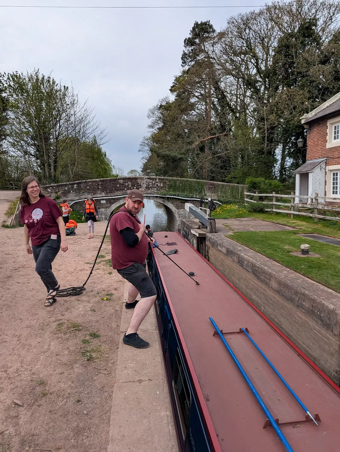
I was getting better at helping with the locks. I was really becoming a good Lock Labourer. Some of the locks are really deep and the gates are heavy but I liked doing them. Hard work and great exercise.
At one point we went through some locks right next to the the M6 motorway. It was loud and full of lorries and not very pretty. Once upon a time there was a lock keeper’s cottage here but it’s long since been demolished. 200 years ago it was probably really beautiful here but today you’d get a motorway for a neighbour!
Would you have wanted to live this close to a motorway? I don’t think so!
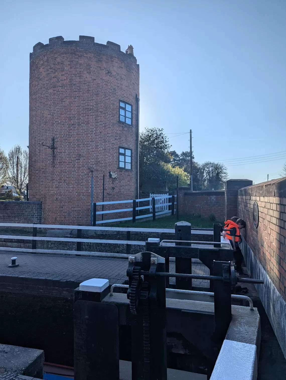
When we got to the Gailey Roundhouse, I got to do a lock paddle all by myself. Dad stood nearby just in case but I did the whole thing. I loved it and was very proud!
Today we learnt that Stoke-on-Trent and Staffordshire are called ‘The Potteries’, because loads of the pottery people used to use came from here. We even went past one of most famous potteries of all – Wedgwood.
We didn’t stop there to learn about all things ceramic but instead we went to the Gladstone Pottery Museum, which is where they film the Great Pottery Throwdown, my sister’s favourite show ever. She didn’t know we were going so it was a surprise. She screamed a bit when she realised where we were.
Inside the museum there were huge old bottle kilns and loads of clay things. We couldn’t actually make anything, but that didn’t stop us pretending.
Afterwards we got something called Staffordshire oatcakes for lunch. I had mine with peanut butter and jam. It looked like a pancake but was way better than a pancake. Very yum.
Later on, we had to stop to fill up the water tank, and while the grown-ups were sorting that we found a playground nearby. There was also a funfair but the adults said no and we were all like “awwwwww come on” but it didn’t work. Still, we had a good runabout.
We finished the day moored near a place called Burston. There were some super posh houses around. It was really quiet though, and peaceful.
We got up super early. The canal was full of birds singing. Not like at home in Croydon. This really was proper countryside.
Today was a lock day. Loads of them. So many that this bit of canal gets called “Heartbreak Hill”. We did 24 locks before lunchtime! TWENTY FOUR! Plus the two we’d done the night before. I really wanted to join in and I began to learn how to use a windlass to open a paddle and let the water in and out.
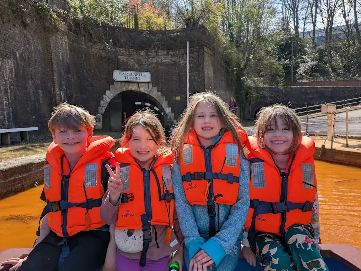
We had to get to Harecastle Tunnel for our booked slot but then my Dad was like “Oh no, I actually didn’t book it”. Oops. So we had to try and rush a bit to get there (not an easy thing to do in a canal boat) and hope they’d let us through. And they did! Thank you Canal and River Trust, you saved my Dad’s bacon.
The tunnel is MASSIVE. It’s 1.6 miles long. That’s as long as walking from my house to school to my house, to school, to my house and back to school again! It took 45 minutes to get through and was pitch black inside (apart from our headlight). I was on edge the whole time because it was a bit spooky but also exciting.
There used to be two tunnels here – one built by a guy called James Brindley, and the other by Thomas Telford which was completed almost exactly 200 years ago. Only Telford’s is in use today. In the old days, people had to lie on the boat and leg it through by pushing on the tunnel walls with their feet. For THREE HOURS. I would definitely not like that.
After we came out the other side, we moored up at Westport Lake. This place was originally created as a ‘pleasure gardens’ during Queen Victoria’s reign but over time it got neglected and became a wasteland. There was a playground which was really fun and we got treated to ice creams!
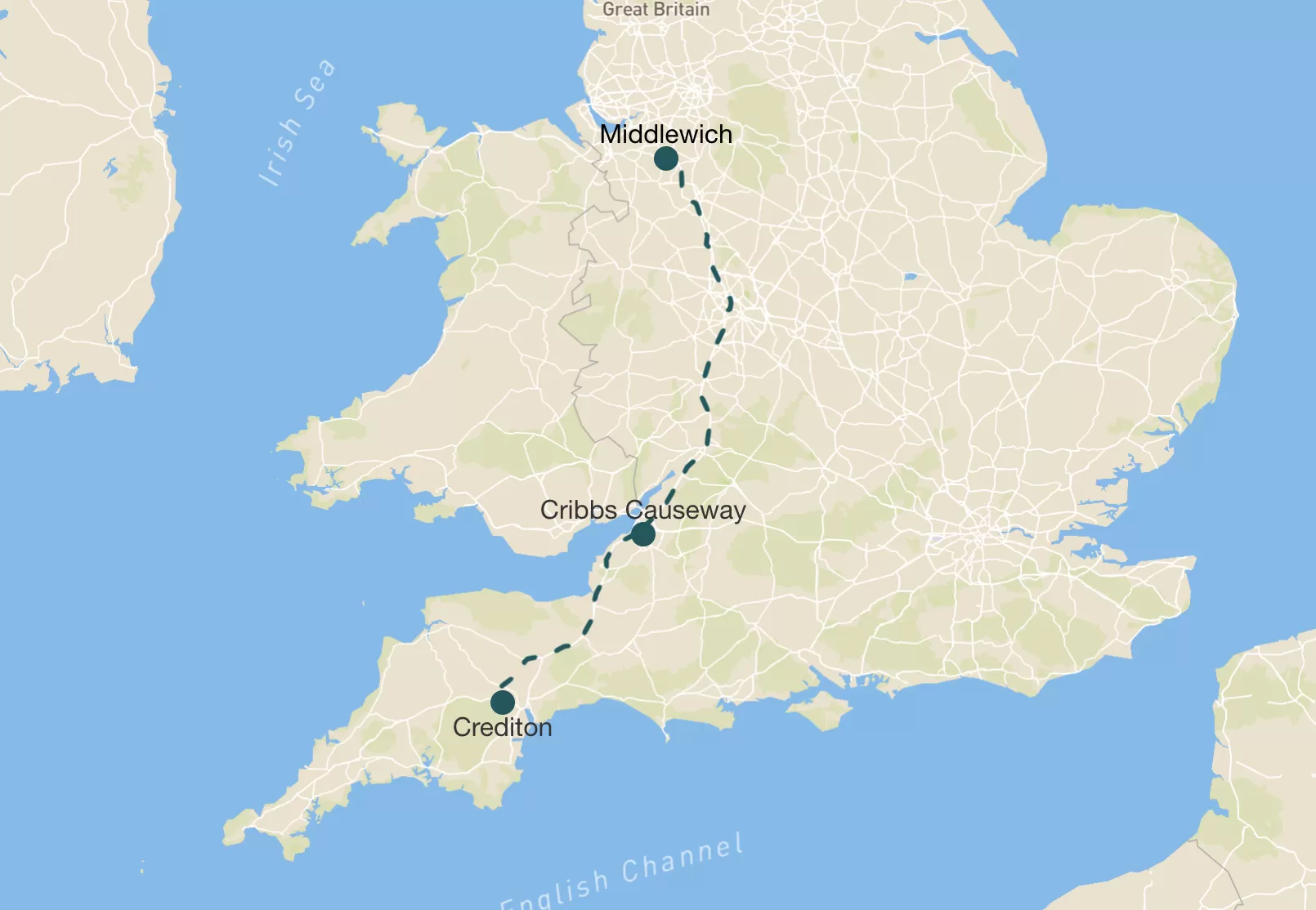
We left Nana’s and drove up to Cheshire. It took ages.
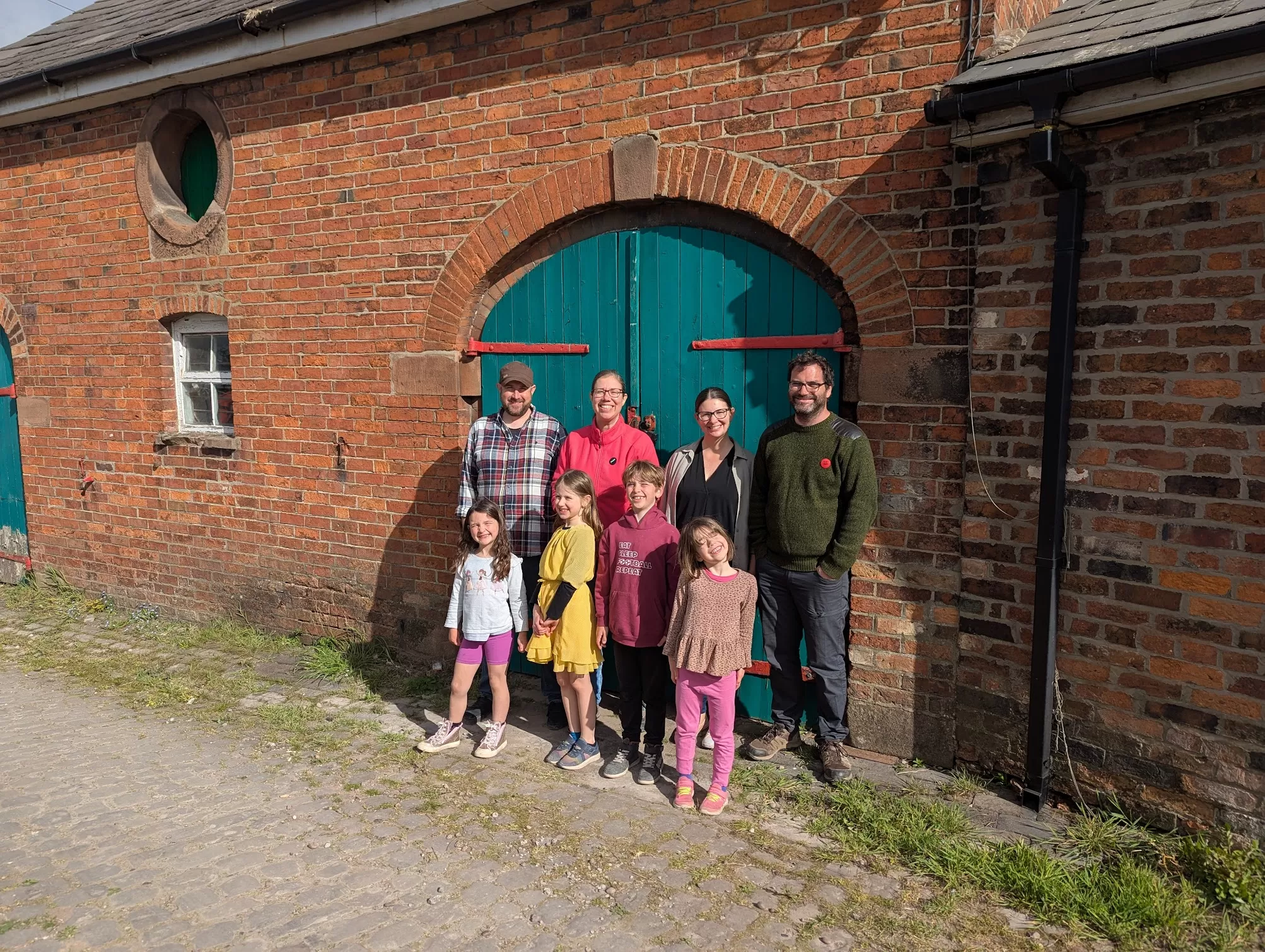
We met up with our friends the Burtons. They’re a family of 4 like us – a Mum (Shannon), a Dad (Dave) and two daughters (Anwen and Zoe) who are a similar age as me and my sister. We met them at Morrisons to a massive shop before we got on the boat. While my Dad did the shopping we ate lunch at a place called Streat.
Then we went to get our canal boat from Floating Holidays. It was called Rakiraki. The people from the boat place showed us how everything worked and fitted our life jackets. I just really wanted to get on board.
Inside the boat looked so cool – it had beds and sofas and a kitchen and even two bathrooms, though more on that later…
I had a go at “driving” the boat. Well, I held the tiller while my Dad drove. And then I mostly stayed inside and played.
I was excited to take the Christmas present my parents got me – Cards Against Humanity (Family Edition). I played a lot of it with my sister Eleanor and Anwen and Zoe while the grown ups got us set up on the boat and moving forward. That game is so funny and a bit rude. It made us all laugh loads.
After we moored near a place called Wheelock we had sausages, mash and baked beans for our tea. Yummy. I was tired but really excited because we were on a boat! A real boat!
Distance travelled: not much, just to church and the park and back
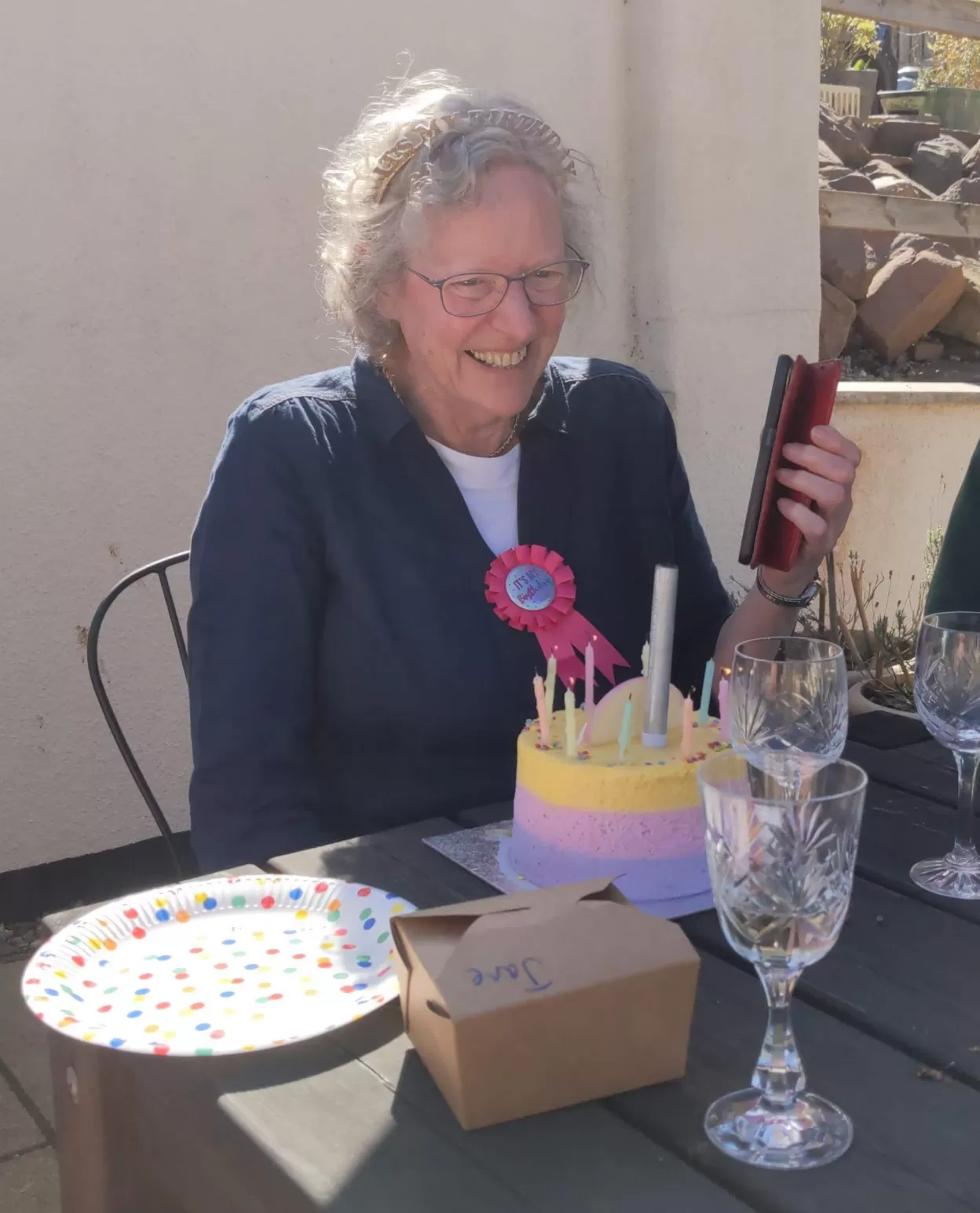
First thing in the morning I gave my Nana a monstrous hug and said happy birthday because today we turned 70!
We went to church but not in the church building, it was in the church hall instead. Nana took cake to share (because it was her birthday obviously). I did some colouring with my sister, and then turned mine into a paper aeroplane.
After church we went to the park while my Mum and Aunt decorated my Nana’s house with balloons and stuff. We came back and had a specially prepared meal of Lebanese food. There was chicken, hummus, pita and some things I couldn’t name but was tasty. I really liked the chicken.
We had lunch with Nana’s friend David and also a Ukrainian mum and child who are staying with him. They can’t live at home in Ukraine because of the war which is really sad.
Then my Dad’s brother and sister went back to London and we watched a film. It was called Hook and I’d never seen it before. It’s a new way of telling the Peter Pan story and I enjoyed it.
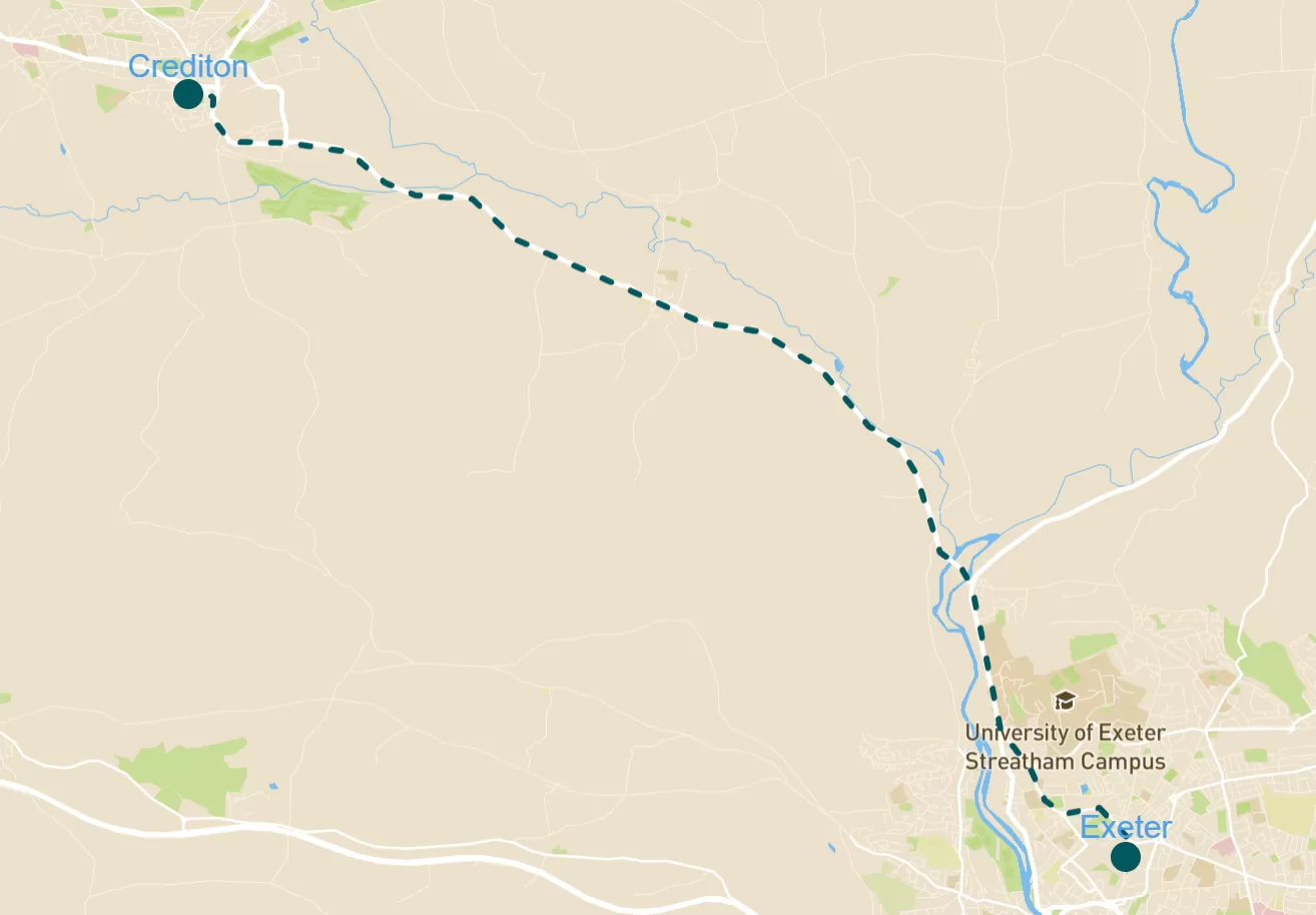
Distance travelled: 16 miles (Crediton to Exeter and back again)
In the morning, we had breakfast and I beat my aunt at chess (yes, really). Then we went to a craft fair at Nana’s church hall. I bought a Liverpool FC bookmark for my godfather.
After that we got the bus into Exeter for lunch. My Nana, uncle and aunt came too as well as my Nana’s friend David. I had sausage, beans and egg with some homemade lemonade.
After lunch we saw a big RAF exhibition by the cathedral. There was a replica typhoon jet! I had an ice cream (dulce de leche flavour, which is basically toffee). My sister had bubblegum flavour which I think is disgusting.
After we got the bus back to Nana’s we had ate pizza for tea and watched Gladiators. Giant, Apollo and Bionic are my favourite Gladiators.
To provide the best experiences, we use technologies like cookies to store and/or access device information. Consenting to these technologies will allow us to process data such as browsing behaviour or unique IDs on this site. Not consenting or withdrawing consent, may adversely affect certain features and functions.
Functional
Always active
The technical storage or access is strictly necessary for the legitimate purpose of enabling the use of a specific service explicitly requested by the subscriber or user, or for the sole purpose of carrying out the transmission of a communication over an electronic communications network.
Preferences
The technical storage or access is necessary for the legitimate purpose of storing preferences that are not requested by the subscriber or user.
Statistics
The technical storage or access that is used exclusively for statistical purposes.The technical storage or access that is used exclusively for anonymous statistical purposes. Without a subpoena, voluntary compliance on the part of your Internet Service Provider, or additional records from a third party, information stored or retrieved for this purpose alone cannot usually be used to identify you.
Marketing
The technical storage or access is required to create user profiles to send advertising, or to track the user on a website or across several websites for similar marketing purposes.